Cottonwood Connection
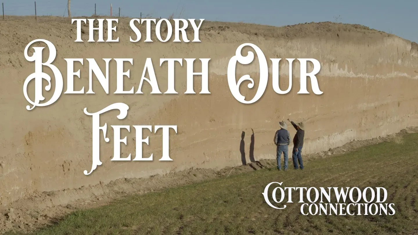
The Story Beneath Our Feet
Season 8 Episode 4 | 24m 58sVideo has Closed Captions
Don is joined by KU professor Dr. Rolf Mandel.
Don is joined by KU professor Dr. Rolf Mandel for a look at the geology of western Kansas and how the land itself is so important to the history of the area.
Problems playing video? | Closed Captioning Feedback
Problems playing video? | Closed Captioning Feedback
Cottonwood Connection is a local public television program presented by Smoky Hills PBS
Cottonwood Connection
The Story Beneath Our Feet
Season 8 Episode 4 | 24m 58sVideo has Closed Captions
Don is joined by KU professor Dr. Rolf Mandel for a look at the geology of western Kansas and how the land itself is so important to the history of the area.
Problems playing video? | Closed Captioning Feedback
Where to Watch Cottonwood Connection
Cottonwood Connection is available to stream on pbs.org and the PBS app.
Providing Support for PBS.org
Learn Moreabout PBS online sponsorshipThe story of the Great Plains is tied directly to the story of the land itself, how it formed and supported the people and animals that populated it.
Discovering that story means looking deep beneath the surface.
Today for Cottonwood Connections we have Dr.
Rolf Mandel who is a geomorphologist and a geoarchaeologist and has worked throughout the world basically.
What have you been doing and what have been some of your jobs and things you've checked out?
Well I've worn many different hats literally and figuratively but most of my time has been spent looking at landscape evolution.
Particularly a strong focus on about the last 20,000 years.
For the past about 40 years much of that work has been tied to archaeology.
In other words I've spent time with archaeologists talking about how landscape evolution has affected the archaeological record.
About 23 years ago I became director of what's called the Odyssey Archaeological Research Program which is housed at the Kansas Geological Survey.
The objective of that program is to use geoscientific methods to look for the earliest evidence of people in the mid-continent primarily.
I also spent a lot of time talking about site formation processes with archaeologists.
In other words how sites get buried deeply in many places or how they might get eroded away.
And so you're tying the land in with the people.
Exactly exactly.
Also today we're about six miles south of Hoxie, Kansas on Kansas Highway 23.
Here this has opened up in the last year and a half with road construction.
I refer to these as my windows into geology and time.
So I'm constantly looking for road cuts.
I'm constantly looking for stream bank exposures.
Something that is literally a window into those sediments.
Most people they're driving across this landscape they have no clue as to what's below them.
That is correct.
And it's often a very complicated story as is the case here.
And this is just one window with a complicated story.
And the window varies as we move up the landscape.
So to begin the discussion of what we're looking at here I think it's good to understand where we are in the landscape.
We're in the Solomon River Valley.
We're fairly high in the valley landscape.
The modern floodplain of the Solomon is to the north of us.
And we're probably somewhere around maybe 70 feet or so above that modern floodplain.
But what's interesting about this is that this used to be the floodplain of the Solomon.
This is what we call inverted topography.
What is now a topographic high used to be a topographic low.
So the river was up here in the past.
So the question is how long ago was that?
Yeah one thing you might notice here is that there's what we call a cut and fill.
The soil's been cut out as we go to the south.
There's a lot of gravel sitting on that contact and continues to the south where that buried soil is almost completely cut out.
And so this represents a gully that cuts into this buried soil.
So again it's high in the landscape today but was lower previously.
And so this was the bottom so where Kansas is so flat is through hills on both sides of this at one time.
Yeah.
And now this is one of the biggest hills.
So that's how it's been cut down and reformed basically.
This really red sediment you see is similar to what we call the Sangamon Paleosol which we see in the windblown sediments around here.
And Paleosol just means ancient soil.
Paleosol is an ancient soil and that clearly is an old soil.
That reddish soil below the lighter zone.
So you notice there's a lot of bedding in it and that's those different layers you see within it particularly lower.
So some of that is gravel and some of it's sand and some of it's silt.
Some of it's even clay.
You can see over here there are some some thin relatively thin beds of clay.
So again keep in mind this was a floodplain just as if you went down to a modern floodplain as you walk across it you'd see bands of clay.
You'd see gravel beds.
You'd see beds of sand.
You'd see beds of silt.
And you do have that repeated with the lower one.
Right.
One about a couple feet above.
So you got you got clay and then it gets sandy and there's some there's some little fine gravels in it.
It goes back to clay and it goes to gravel here.
And at the very bottom of the section there's a carbonate.
This white you see we call it calcium carbonate.
Commonly referred to as caliche.
That actually may be the top of the Ogallala because you typically see a cap rock of caliche or what we call carbonates that mark the top of that of that formation.
So a caliche zone like this you have to think that was at the surface at one point in time.
So it was it was part of a soil and to get a caliche horizon that's that well developed.
We're talking about you know 30 40 maybe 50 000 years of stability.
Well and I know where you get some of the vertical things allegedly that might have been an old root zone or something.
Right.
That it came down.
Yep.
If that is indeed the Sangoman Paleosol then we're going back at least 60 000 years ago to about 130 000 years ago.
There's nothing there to date in terms of carbon.
Even if we could date if we found like charcoal in it it's beyond the age range of radiocarbon.
Because age the the oldest datable material by radiocarbon is 40 000.
That's as far back as you go.
While we can't use radiocarbon dating what I'm thinking about doing actually is coming back to this locality and we can hammer these hollow tubes into the section and date the sediments by what's called optically stimulated luminescence or OSL for short.
And that actually tells us when the grains were last exposed to light before they got buried.
The key is we don't want the grains to be exposed to light.
If the cores are... if the tubes are exposed to light if the sediments within those tubes it resets the clock.
Because we want to know when was it last exposed to light before it got buried.
OSL can take you back hundreds of thousands of years.
But you know right now it's entirely guesswork just based on the lithology.
Lithology is the color of the sediment.
It's texture and also thinking about where it's at in the landscape.
You know this whole stretch we're going to look at you know it's a great lesson.
You know I'm also a professor.
I teach geoarchaeology landscape evolution at KU and this is the sort of place I'd bring my students.
I'd say look look at these sediments.
Tell me what the origin is.
We're going to go up the hill.
Look at those sediments.
Tell me what the origin is.
And so those the sediments tell the story.
So it's a great learning opportunity in a place like this.
So you notice that it goes from this really reddish sediment to grayer sediment on top.
The bottom of that gray zone to right about I'm going to say right about here is all a soil.
That is one really thick soil.
The reddening of that soil is partially a product of a long period of landscape stability.
In other words the longer that sat at the surface before it got buried the more oxidation occurred.
And oxidation produces red colors.
It has to be iron in the soil a little bit for oxidation.
There has to be iron in the sediments that can that can then oxidize.
Soil formation is it's a it's a weathering process where the original sediments again these were floodplain sediments.
They weathered in place and the longer they weathered the more oxidation occurred.
And it could have been wetter.
Wetter conditions can enhance oxidation as long as it's not totally saturated.
Yeah because oxidation is basically rust.
Yes that's the that's a good layman's definition.
It is rust.
Most of what we're looking at above it is just gray sediment that has not weathered in place like this has or for as long a period of time.
Again that's why you have to have lots of samples across a large area to understand landscape evolution in general.
As an example we moved just a few miles away to see another cut with different soil.
So we're uphill from where we were.
But we're looking at much different sediment.
This is just a great example of the Peoria Lus, which is this sort of light gray sediment that spans most of the exposure.
Lus it's windblown sediment and it's in particular it's it's mostly silt size.
Most of the dust that accumulates in your house is silt size.
It's baby lus.
Is lus.
I mean lus is still being deposited today.
The Peoria Lus that you see here mantles pretty much the entire high plain surface.
So it is the youngest of the lus's.
The next oldest is the Gilman Canyon which is below it.
So that that used to be at the surface and then it got buried by the Peoria Lus.
Why is it dark?
Why is it darker?
If all this is lus, why is this?
It was very slow sedimentation compared to the lus above it.
And so there were plants growing on it, probably a prairie like what we see today, you know, which tends to be organic rich.
All of a sudden we see that the sedimentation rate accelerates after Gilman Canyon time.
So where did the name come from?
Gilman Canyon.
These are type localities.
The type locality of the Gilman Canyon is in Nebraska at Gilman Canyon.
What's interesting, you know, the Peoria Lus, the type locality of the Peoria Lus is Peoria Illinois.
So if I dropped you into Illinois into a section of Peoria Lus, it looks just like this.
And so a lot of these names come from a location where they were first defined and studied.
That's referred to as the type localities.
It's a really good index.
It's a marker in the stratigraphic sequence.
So that enabled someone like me to walk up to a section and go, that's a Gilman Canyon.
I know where I am more or less in time.
And so we know from both radiocarbon dates and OSL dating that the Lus that's in the Peoria that this began accumulating approximately 35,000 years ago.
Until about 13,000 years ago.
The date of a material we've actually found pine cones and spruce cones and needles in the Peoria Lus.
We know that there were trees, spruce and pine, you know, widely spaced trees with grass in between.
Because we know at that time that there were mammoth and there were camel across that landscape.
All those animals became extinct.
Around 13,000 years ago.
The other thing is we know, we also know where this Lus came from.
Now I'll say that it's not all a single source.
Some of it is silt that's blown out of the Ogallala.
Some of it's silt that's blown out of river valleys.
But the bulk of this actually came in what's called the White River Group, which is a bedrock unit in the Badlands, which by the way is a silt stone.
And what happend was when things got dry in the Badlands, the winds came along and they were coming out of the north this was during the Ice Age.
Again that Ice sheet is further north but the cold air blowing off was going across the Badlands picking up the weathered bedrock, the silt, carrying it over the Sandhills.
It didn't stop.
And the reason we know that is because some of my colleagues have geochemically fingerprinted the sediment.
That's a common term where they collected samples out of the Peoria Lus and looked at the geochemistry and they go to the Badlands and analyze it and they're the same.
Same stuff.
Same stuff.
Because it was a mystery for decades, centuries actually, as to where did this all come from.
There's a Crotovina.
Is it here?
Yeah, I see there's a really good one.
Yeah.
All there.
You see that circle with darker soil in it.
And that represents an old animal burrow We call those Crotovina.
It's a Russian term.
This is also probably a Crotovina.
There were critters.
Yeah.
You know, there were prairie dogs.
So we've been really focusing on the Pleistocene, the Ice Age, the last about 2.6 million years and particularly the younger end of the Ice Age.
So what we want to do next is go to a locality further west which is near the town of Canaredo.
Instead of looking into Pleistocene, we're going to look at the Holocene.
So and we're also going to talk about the human component of that landscape.
You know, the people were there for sure.
And so this is an archaeological site where people actually were.
It isn't just soils in the age of those, but this is connecting the people with the soil.
In the late 1960s early, into the early 1970s is when I-70, the highway was built.
They decided to channelize Middle Beaver Creek.
When they were doing that work, they uncovered both mammoth and camel bones.
So they contacted a paleontologist from the, what was then the Denver Museum of Natural History.
In his notes, he mentioned that there were what appeared to be artifacts laying on the ground out of place.
Dr.
Stephen Holen, who did his PhD at the University of Kansas in the Department of Anthropology, when he finished, he went to what was then the Denver Museum of Nature and Science.
And he looked at the bones and he noticed that some of them looked like they'd been modified by people.
So he contacted me and said, "We ought to go out and just take a look at this and see if this is indeed an archaeological site as well as a paleontological site."
And indeed, we started finding artifacts.
Our initial thought was that perhaps this was the first Clovis site in a stratified context anywhere in the central Great Plains had been recorded.
In the bottom of this excavation area, we found in place quite a few mammoth remains and quite a few remains of American camel.
And so we knew we were into the Pleistocene, the Ice Age.
We also found mammoth remains right about here and bison remains right about here.
There were some artifacts both here and here that were lithics, basically just chert flakes.
In this horizon, we discovered not only chert flakes but also parts of projectile points that are Folsom or Midland, which are the same age, that's late paleo and some really distinct hide scrapers.
So we know that there's a Clovis Age component.
I say Clovis Age because we never found any diagnostic Clovis points or preforms.
But it's the right age for Clovis, just right on the money.
In this lower zone where we found all these mammoth and camel bones, there were no lithic artifacts.
However, Steve Holen, upon looking at the bones, made a strong argument that the bones were modified by people.
He saw green bone spirofractures and there's one particular bone that is, I believe, a rib bone that's beveled on both sides and polished.
And there's no evidence of gnaw marks on it and it looks like a tool.
So there's a potential pre-Clovis component.
So you know, it's a really, it's just, this is a really important site.
We can argue all day about whether this is pre-Clovis, but the fact that we've got stratified Clovis Age and stratified what's definitely Folsom slash Midland really puts this site on the map for North America.
You want to point out the, should I point out the Crotovina?
Is that right?
Crotovina is very important.
So there's Crotovina showing up here.
This feature here is a Crotovina much like we saw at the last stop looking in the Peoria Lus, although obviously we're looking at different age material and a different animal.
It could be a Pleistocene beaver that was digging into the bank because remember this was a slowly agrading floodplain.
And so there were probably beavers and they burrow into banks.
So this could be the product of a beaver.
Speaking of animal evidence, we moved to a site down the draw where Don made a discovery.
You got a bone over here.
Oh yeah.
Huh.
That's a big bone.
That is a big bone.
That is certainly at least bison size, maybe bigger.
Yes it is.
Could that be mammoth?
I haven't dug enough mammoths to know.
I've only seen little pieces.
Oh there's the end of it.
Yep.
This is probably a, from the Folsom component.
We did find bison in the Folsom component.
Dr.
Mandel later notified us that the bone was in fact from an ancient North American camel.
So we pulled into a second site and so I get out and I notice all this heavy rocks.
It is a large gravel, usually for road filming stuff you see light, a lot lighter stuff.
Dr.
Mandel, why is this here and it isn't up there?
Okay, well first of all, we need to know where we are geologically in terms of the gravels.
This is the Ogallala Formation.
So the Ogallala is really shallow here and these are gravels derived from the Ogallala and if you look at the gravels there, like this one, this is a basalt so it's volcanic.
There's quite a bit of basalt scattered through here.
There's some granite.
It's not local rock.
It's derived from the Rocky Mountains.
So yeah, so how did this form?
So what you have is the Rocky Mountains were uplifting during the Miocene time.
You had these enormous alluvial fans that were coming off the mountains and braided streams and they were spreading all this coarse sediment across the high plains which tells you that because look at the size of the gravels, they were what we call very competent streams to move such big material, heavy material.
So a lot of water and a very high velocity on a steep gradient and this goes clear into the central part of Kansas.
Yes.
There's fingers of it out just like you'd dump out a bucket of mud somewhere.
You have some running off but then when you start seeing all that lus deposition that we looked at at the other localities in the Solomon Valley, all of a sudden we have all this fine-grained silt that's available for the streams and low and behold, here it is.
Yes.
It's eroded off the uplands and becomes sediment that's deposited by the streams.
The stratigraphy here is very similar to the last site and there were artifacts associated with them, nothing diagnostic but this is these are perfect ages for Clovis.
So again we have a Clovis age component.
Right about here we had a date on bison, several dates of around 10,300, 10,400 years uncalibrated which would be Folsom time.
This is also where we got a the tip of a Folsom point and the base of a Midland point.
The other thing I wanted to point out is that on the opposite bank we put in a test unit there and uncovered an articulated bison.
On the opposite bank there were more bison remains.
Because we find these thumb-sized hide scrapers that are fulsome diagnostic, we think that there was a bison kill over there and they dragged the the hides over here to process them.
So we suspect that it's either a very late Clovis kill or a very early fulsome kill.
And for continuity we still have Crotovina.
Right, oh yeah.
Rodent runs, not only the holes but part of the runs.
There's an active burrow here which probably is a badger from the size of it and that'll eventually become a Crotovina in fills.
So that's sort of the modern analog of what soon will be a Crotovina.
Right.
So you know when you're when you're walking across the surface of this landscape you really don't have a sense of the complexity of the deposits beneath the surface or the age of those deposits.
And so by spending, and this often takes decades of work, you know I've spent decades out here looking at stratigraphic sections, taking cores, some cases even putting in backhoe trenches to create exposures that show you what's beneath the surface.
And what it reveals is that it's a pretty dynamic landscape.
You know some people look at just the flat high plains they say oh that's that's it.
Well there's a lot more to it.
So there's lots of stories.
You know when I look at a landscape I'm always thinking about it in three dimensions.
You know not just what's on the surface but also what's beneath the surface.


Support for PBS provided by:
Cottonwood Connection is a local public television program presented by Smoky Hills PBS