Cottonwood Connection
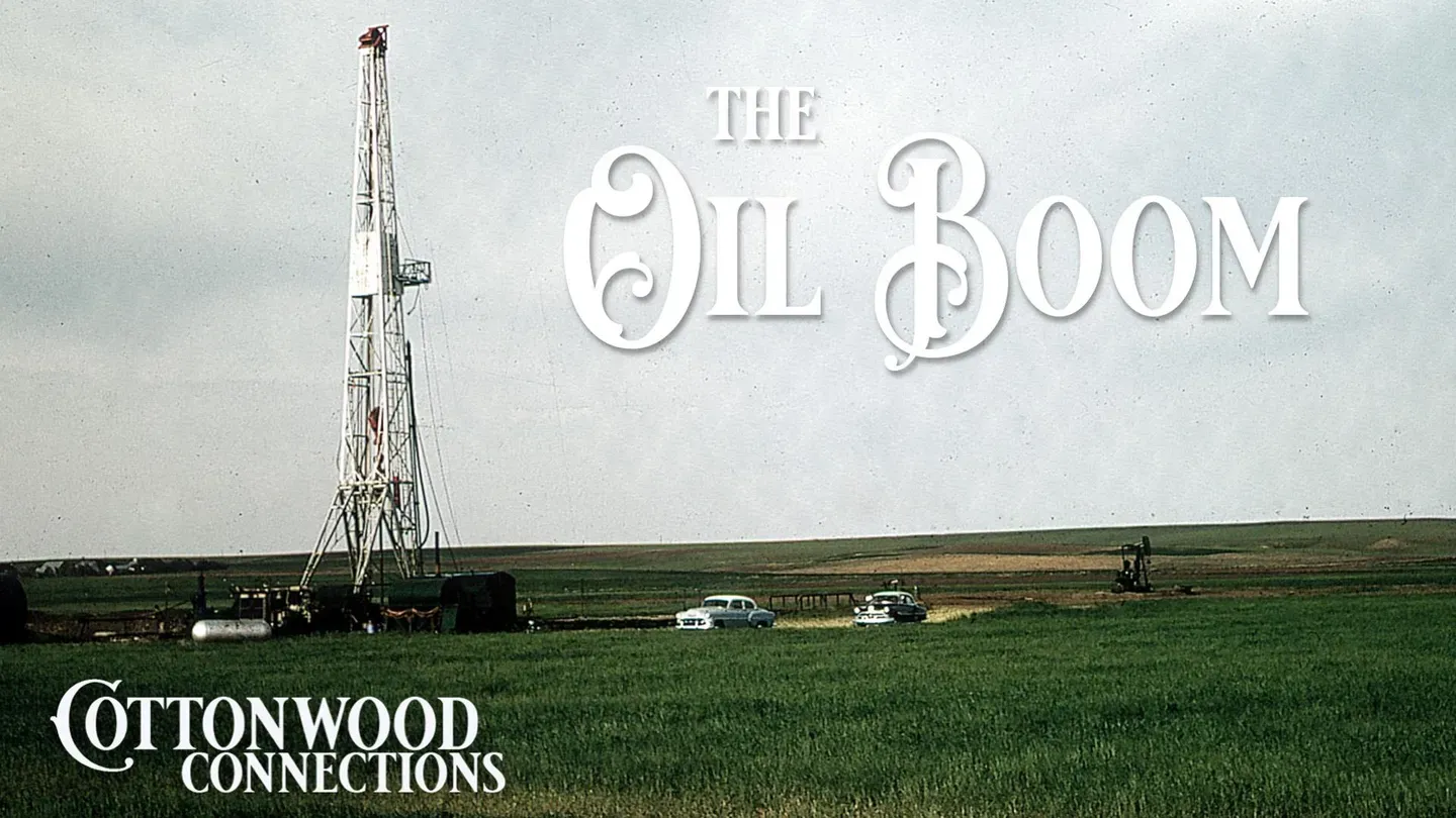
Oil Boom
Season 6 Episode 8 | 24m 58sVideo has Closed Captions
The Oil Boom shaped the High Plains, join us as we take a deep dive in this time period.
When oil was discovered on the High Plains, communities felt a new serge of promise with the hope of a booming economy. For some it meant boom, for some, bust.
Problems playing video? | Closed Captioning Feedback
Problems playing video? | Closed Captioning Feedback
Cottonwood Connection is a local public television program presented by Smoky Hills PBS
Cottonwood Connection
Oil Boom
Season 6 Episode 8 | 24m 58sVideo has Closed Captions
When oil was discovered on the High Plains, communities felt a new serge of promise with the hope of a booming economy. For some it meant boom, for some, bust.
Problems playing video? | Closed Captioning Feedback
Where to Watch Cottonwood Connection
Cottonwood Connection is available to stream on pbs.org and the PBS app.
Providing Support for PBS.org
Learn Moreabout PBS online sponsorship[music] In the 1800s, fortune seekers rushed to get across Kansas to the gold and silver mines of Colorado.
But in the 1900s, they came to Kansas, drawn by the allure of black gold.
[MUSIC] In 1923, a major oil discovery was made near Fairport, Kansas north of Russell at the Cary Oswald site.
To learn more about this history and the industry that would grow up in northwest Kansas as a result, Don visited John O'Farmer, Incorporated in Russell.
So today we're talking with John O'Farmer II.
Third.
I'm the third.
You're the third.
These are the fourths.
Okay.
John O'Farmer II is over there.
So really, I guess with the transition or evolution of oil, they probably started in Oklahoma first and then moved north basically.
You know, if you go back to the Civil War, they were actually doing a little shallow drilling in the Kansas City area.
And World War I, they drilled the El Dorado field.
Okay.
And the El Dorado was drilled in like 1915.
And I mean, it was huge and it really supplied a lot of the oil for us to win that war in World War I.
And that was a surface geology feature.
Taking a look at surface geology, get some ideas of where the features might be.
The geology, for instance, in the Carrie Oswald, the only geology they had was surface geology.
They were mapping these different beds.
And it's McNutt.
McNutt Report.
And he was from Oklahoma City.
And he described anticline, surface anticline, right north of the little town Fairport.
To help illustrate the conversation, John Farmer IV also took us on a tour of the Russell County Historical Society's Oil Patch Museum.
This anticline, dad referred to the Fairport pool with the anticline.
So this is, the anticline means it's a dome type structure with closure on it.
And this is where you have your oil at the top of it.
And if you visualize oil in a coffee cup, if you turn it upside down, oil will float to the top.
So this is what the reservoir would be, would be like this.
So you have oil inside of a sandstone, and then you have limestone on top of this.
So this would be your seal that would hold the oil from going up higher.
And then, so this is, this is what an anticline looks like.
There was a well drilled, about 20 miles southeast of Hoisington.
And it had a, had a little oil show at the bottom of the hole.
He said in his geology report, he said, we could be 200 feet higher over by Fairport on these same zones.
So that was what was drilled on.
It's just an incredible day in 1923 and oil was discovered and here we go.
This is some photos of the Lucky 7, the Ligates, Mismar, Sealy, and then Charles Hall and Shafer and Stearns and Struder.
They were the ones that were drilling the Carrie Oswald.
A lot of these were local businessmen, but they were the Lucky 7, which drilled the Discovery Well in the Kerry Oswald and the Fairport Pool in 1923.
The closest well was 120 miles away.
So you talk about a wildcat, holy criminy that was a wildcat.
It just set this place on fire and it was, the impact was huge for the western Kansas.
It set off everything.
One of the oldest companies in this area is Kruger Oil Company out in Natoma.
And it was after the Carrie Oswald, just a short time later, they found the Leighton Pool in Rookskine, north of the Kerry Oswald.
So it just exploded.
So the Kerry Oswald was discovered on Thanksgiving Day 1923 and it really set off a firestorm of people locally.
And there was, the local people would come out when they were drilling right after the Kerry Oswald and there would be, they'd come out on Sunday afternoons.
And this was kind of their entertainment on Sunday afternoons.
That was big for everybody to go out and watch them drill and bring these wells in and ended up having little ice cream stores and gas stations out there in the country.
And that was everybody's entertainment on Sunday afternoons was to go out and watch these wells come in.
So it's not only geologic but it's also cultural.
Yes.
We had honky-tonks and all kinds of beer joints and nightclubs.
I mean it was something.
I mean the population of Russell probably wasn't enough manpower.
They came in from outside.
It was, we came in pretty good size down overnight for a while, you know.
And Russell was, you know, it was about 2,200 people and when oil was discovered there were no paved roads and within six months I think they had 14 blocks of paved roads of the discovery of the Carrie Oswald.
And then in 1934 it continued to grow, the community continued to grow and we went from 2,200 people to 5,200 people by 1940.
And so we got cobblestone roads and stuff like that after.
And that's hard to absorb that fence.
Yeah.
Yeah this just said everything.
I think you got people in Hays, Great Bend, Russell all over coming and a lot of the experience they gained was from El Dorado.
There was an influx of people from Tulsa, Wichita and El Dorado.
Those were the three main communities where people moved to Russell for the oil.
And Russell had many, many camps as well.
I know there's been a Texaco camp and there was Carter Oil had a camp south of Russell.
I mean virtually all the majors had camps right in and around Russell so that was a major boost to our population and probably a boost to the types of people we attracted as well as far as engineers.
Yeah because it built up the schools, built up the taxes.
At one time I think there were 75 greats brought into this area.
Wow.
What always impressed me when I'd come here to sporting events in the 1960s that Russell literally had oil wells in her back yard.
Yeah.
I always thought that would be on.
We had a refinery here.
Right here in Russell, Kansas.
Yeah we actually had two refineries.
We had two refineries here.
One of them was owned by Krueger.
One of them got owned down by a wind store.
A lot of times people ask you know how do you drill up rock and well we use a drilling bit and this is a type of drilling bit that we use to do that.
This one's called a button bit.
This is probably the most common that we use today.
It's the most modern out of these bits that you see.
These are tooth bits.
This would be more for surface casing to protect the shallow water.
We'll drill down below usable water and we'll set some surface pipe in the ground to protect the groundwater and we'll go through the inside of that and with another drilling bit inside the casing and this is where we start looking for our different formations as we go deeper.
Typically a lot of times there's buttons and sometimes they have diamonds on them and then we have these little jets that you can maybe see right here.
So when we're circulating what we're doing is we're drilling up all this rock and these jets are flushing the bottom of the hole.
So as you drill up rocks, these rocks, you need to remove them and get them out of the hole or else you'll get plugged off.
So these rocks are pushed up to the surface and that's where the geologist looks at them at the surface and to see if there's shows of oil and gas.
The surface geology to drill this Carrie Oswald, they were comparing surface rocks with the surface rocks down there and they did have a well.
They knew that it was they they had described these a good description of that well and they were trying to make a mirror image of that 80 miles away, which is that's crazy.
Which they couldn't see those very rock layers.
That's not unlike how our companies discovered the Norton pool.
My dad was in Oklahoma City and he had lunch with the geologist and he said, "John, I have an idea in Norton County."
In Norton County, Kansas.
He said, "I ran samples on a well south of Norton and it had a little oil show in the samples."
He said, "Five miles north there's no arbuckle."
He said, "And drill a big circle."
He said, "I think somewhere in between there is a big oil field."
Now on that information, he stuck that in his pocket.
They leased that and drilled it and discovered the Norton pool and over a hundred arbuckle wells with a recovery of over 100,000 barrels each.
That was a big deal.
Real big deal.
The most prolific producing zone in Kansas is the arbuckle.
It's an erosional surface and it has many, it has several productive layers in it and it's high porosity, high permeability.
It's what you want.
Big water drive reservoir.
You want an arbuckle well.
Tell me a little bit about yourself.
When you've got into the oil business here in Kansas or Russell County particularly.
Well, I'm a second generation.
My father was an engineer with Otis Pressure Control.
He was their first engineer after World War II in 1946.
He had an opportunity of a lifetime to come here and start a company.
It started out as Jones Shelburne and Farmer.
Jones, his Fred Jones.
He was an orphan with a third grade education and a master fortune.
He became, he was good friends with Henry Ford.
His dream was to get an assembly plant, Ford assembly plant in Oklahoma City and he did it.
He started three oil companies.
We were one of them.
We came up here with five drilling rigs.
He was, I mean, we were getting after it.
Granddad came out in 1946 and he was, he had virtually nothing to his name and he started out with Fred Jones and Sam Shelburne.
Sam Shelburne was my uncle and he'd been in the oil business since the 30s.
And Granddad had nothing.
He went to school with $50 in his pocket and, but he came out and of course these other two had the financial backing to do it.
Granddad didn't and I think he drilled 10 straight dry holes.
13 straight dry holes.
And he was ready to throw in the towel and say that this is, I can't, I can't do this.
And then they encouraged him to go one more and that's when they found the Madden Lease in the Beamus Field.
And you know, that was about almost 80 years ago.
So that, that was awful big that they kept him plugging away to try to keep going because the legacy wouldn't last if he, if he had thrown in the towel.
He had a pretty good partner with Fred Jones.
Yeah.
And Sam Shelburne too.
Oh yeah.
Okay.
Now we're outside at the Russell Oilfield Museum here in Russell, Kansas, right off I-70.
You can hear the traffic.
This is an old rotary rig that John O'Farmer incorporated.
I don't know if you can see it says John Shelburne and Farmer.
That was our original company.
This is an old Leasey Moore rotary rig that we donated after we took it out of commission.
This would have been fairly modern compared to all the other equipment here in the, in the museum.
It has a rotary table that spins a Kelly.
And what happens is that that provides the torque on the bit for that this down hole.
So it's spinning really fast.
That drilling mud's going down the inside of the drill pipe and coming out the outside where the hole that you just cut.
So a lot of people moved initially to Russell and the original, the discovery well was a Carrie Oswald in 1923 in the Fairport field.
Not far, long after that, right to the, to the southeast of Russell was the Trapp and Hall Gurney field.
Those fields go all the way down to the Barton County line.
Then you go right across the Barton County line.
Those are the like the second and fourth largest fields in the state of Kansas.
Then you go to the Chase Silica, which is probably the third largest and then the largest field in the state of Kansas is the Bemis.
The Bemis field is just north of Hayes.
So if you were to look at a map, these are almost kind of lined up from southeast to northwest.
So this is all up on top of the Central Kansas uplift, which is the oil migrated out of the Anadarko Basin up to this area.
That's why you see so many oil wells is over the hundreds of millions of years that oil just accumulated under this big uplift, which is located right here, pretty much right on top of Russell, Barton, and Ellis County and right here where we're at today.
So, you know, first you had the surface geology mapping from some people, individuals out of El Dorado and they noticed a Cretaceous or post-rock fence, fencebone, limestone, and a cline across the Fairport area.
And then I would imagine initially a lot of the reason things were drilled was closelogy.
So you would start at the Fairport field and you would just try to gather leases as close to that, just try to and then you start drilling and you start drilling looking for oil.
And if you have a show hole, in other words, if you have oil and water, you might try to think, well, maybe I need to go North or South or East or West from that well versus other wells.
So you start doing some surface mapping.
So that will kind of be the second stage is doing surface mapping and the more wells you've got, the more data you've got and the more accurate you can get with subsequent wells.
You create information as you drill.
Yeah.
And when you start out, there's no information.
So you drill a well out in the middle of nowhere, but each well, then you have information from a well in the ground and that is very valuable.
So I'm going to ask you too a little bit about, we talked about the ground geology and stuff and now everything is seismic.
So how does seismic work?
The 3D seismic is where you basically are getting a 3D image of what's underneath the ground.
And if you would think of it like a sonogram.
So you're sending sound waves down into the ground and you have these different contacts.
So you have a shale and a limestone.
So at that contact, some of that energy will be reflected back up to the surface.
So this is a poster on 3D seismic.
This illustrates kind of what we visited about earlier.
This would be the layout if this was a square mile with the sources in black at an angle.
And there's, you can see there's thousands of them.
When you see the big seismic trucks, what it is is they're putting energy down.
It's hitting a layer underneath the ground and it's being recorded maybe at four or five thousand different locations when they lay the wires out.
So it's recorded at each one of those locations.
They'll be vibrating at one of those black spots and then recording at every single one of the blue spots.
So you end up getting a sonogram of the earth and what that looks like is this would be like a side view if you cut it out.
So if you're looking at the length at the horizons as you go down, you can see that this is a little bit higher than this in structure.
And then you can see there's some low spots here where these are channels and when you start mapping them from above, you start getting these channels coming out.
And this is what the structural looks like in 3D seismic width.
The white's being high so that would be the highest part.
This would be kind of a ridge with another ridge over here and this would be a deep low.
This is probably faulted on this side.
And before 3D seismic, we would drill subsurface mapping and success rates were seven to ten percent.
Now that we use 3D seismic, your input costs are much higher but your success rates are 55 to 60 percent, something like that.
And you're finding better wells because you're drilling right on top of the reservoir.
Taking a look at surface geology, get some ideas of where the features might be and then detail it with 3D seismic and blending those old and the new and have been found some nice production in the Simpson sand that the fields aren't very big, they're small so that they're prolific.
And this is actually, we've actually discovered a new field that we're water flooding here and this was a fantastical field north of Bunker Hill.
So what water flooding is, is if you've got multiple wells, say you've got six wells in a circle that's pretty close together, what you can do is you can start injecting water typically in the middle well.
So say you've got three wells here and three wells here, you would inject maybe two wells in the middle, like in a situation like this you would probably inject water into this well right here and it would push oil out to these surrounding wells.
The oil sits there and it doesn't have any energy to move and what you do is you're providing energy for that oil to flow to the other wells and typically that works very well in gas drive reservoirs like the Lansing Kansas City which we have here in Kansas.
So when you get on a roller pretty close together, was it better to put as many wells in as you could or do you want to put fewer in and last longer?
Is that just all determined by economics?
No, let me say it.
If you can drain something with one well, you're better off money-wise to just, but if it takes two wells to drill, to drain 40 acres, you better do it.
You need to study that and figure that out because over drilling it doesn't do anybody any good.
That's what they did in the olden days and they you could almost walk from derrick floor to derrick floor, you know, it was just a sea of, yeah, that was wasteful.
There you see those old old pictures but you can pump them dry.
Yeah, but not all of them.
The flush production is from statewide basis is over with.
Yeah.
It'll be the operation of these little mom and pop two-barrel day wells and there's a jillion of them and each one of them is kind of its own little operating entity.
It pays taxes, it employs somebody, it's worth keeping but you can't spend a lot of money on them and some of them if they don't have corrosion problems will last a long, long time.
I have a friend that has a small interest in a well in Pennsylvania was drilled in 1900 and it's still producing a little tiny bit of oil but it's there, you know, we have thousands of these wells and it's they're worth keeping.
Okay, this is a Jensen pumping unit from 1934 and this would be one of the very early Jensen units that they that we used.
The first ones were all mainly wood and then Leasey Moore came out with a pumping unit which was the first one.
I think they're out of Oklahoma but they were steel and then Jensen came out.
This one, particular one looks like it came out 1934 but what that what they are is you've seen them all over I-70 and stuff when you're you're going up and on I-70 in western Kansas but what these pumping units are doing is making the only thing they're doing is making this head go up and down and that the sole purpose is to try to make the sucker rod which has a downhole pump on the bottom.
What you're doing is you're loading that pump with fluid inside the tubing and you're bringing it to the surface.
So a small unit like this with a small stroke so in other words if it's just going down 18 inches it's not going to move much fluid.
As you're driving down I-70 if you see a large unit that's going really fast common sense would tell you that's a larger fluid well.
So this would be for a very small fluid well as well as some of these other wells here at the the whole patch museum here in Russell.
Anytime you produce a well the primary production that well is going to decline over time so it's always going to be better yesterday than it is today and so over time it it it will decline down to where it's is non-economic to produce.
Today the average well in the state of Kansas i think is 2.1 or 2.2 barrels a day so so that's i mean if you've got to watch your costs really gotta watch your costs and and you know if these things are not economic you're better off just to plug them in.
It all started with the Carrie Oswald in 23.
We came here 46 you know 20 some years later.
People had experience from the Eldorado the the drilling of the Eldorado field and they there was a lot of and a lot of that was transferred here uh to exploit this because it it set off a boom of everything that you know and the wells in Russell County and Ellis County were just fabulous and they still are.
We these old reservoirs just never keep giving up oil.
Our first well we operate is our Koona number one South Bunker Hill and that well is still producing and that unit is still making money.
Wow.
It just drains a big area and put in a successful water flood.
Now that's very unusual for that to happen but most times the wells go totally dry and then they're done but in some of these big old fields they just never seem to be done.
Well I came back to work in in 1991 and I moved into my granddad's old office and you know we started this company in 1946 and I was cleaning out his desk and in the back of the desk drawer was a article from the Russell, Russell County News, Russell Daily News from 1965 which was a year I was born and it basically had was asking my granddad in 1965 what the future of oil and gas industry is and he said exploration is pretty much done.
He said the only thing left is water floods and so we're here we are 60 years later that story is exactly the same thing.
60 years has endured a lot and it seems like it's we're still at the same place we were 60 years as far as where this industry is going so.


Support for PBS provided by:
Cottonwood Connection is a local public television program presented by Smoky Hills PBS